top of page


Everything in Life is Vibration.
Albert Einstein
Your Vibration creates 3D Rhythm.

IOT PROJECTS
INTEGRATED GIS MAPPING
It is now possible to collect quantities of data but also to control different pieces of equipment or monitor the Internet of Things. A growing number of users are starting to adopt digital technology and data-driven innovations.
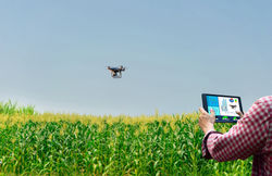
Some of the advantages of utilizing drones include imaging, integrated GIS mapping, potential to improve yields and save time. With strategy based on existing data collections and processing, the drone technology offers a high-tech makeover to different industries such as farming or healthcare...


 |  |  |
|---|---|---|
 |
bottom of page